The Floating Lake of the Faroe Islands That Looks Like a Real-Life Infinity Pool
Some travel photos make sense the moment you see them. You don’t need anything extraordinary: a beach, for example, is pretty self-explanatory. You just look at it and immediately appreciate the beauty. Then you come across an image from the Faroe Islands that feels harder to read at first. A long, still stretch of water sits high above the Atlantic, and the framing makes the sea below feel much farther away than it actually is.
The place is real. It is Lake Sørvágsvatn, also known as Leitisvatn, on Vágar Island in the Kingdom of Denmark. It is the largest lake in the islands, covering about 1.31 square miles, and sits roughly 105 feet above sea level. The effect people notice comes from the cliffs, the distance, and the viewing angle that lines the lake up with the ocean below, creating that striking sense of separation between the two.
The View That Tricks The Eye
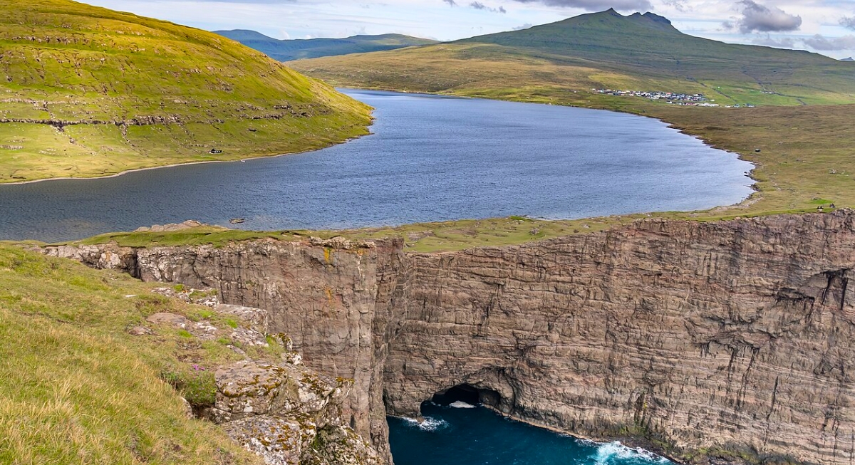
Image via Wikimedia Commons/Ekrem Canli
The best-known viewpoint is near Trælanípa, a cliff on the southern side of the lake. Stand in the right spot, and the land between the lake and the ocean disappears from view. The cliff hides the real drop, the lake seems to meet the skyline, and the Atlantic spreads out far below. The result is the “floating lake” illusion that has turned this quiet corner of Vágar into one of the Faroe Islands’ most recognizable scenes.
This happens because the lake and the ocean sit at different levels, separated by a stretch of land that is out of sight from that angle. The height difference is only about 105 feet, not anything dramatic. Still, the brain fills in the gaps in its own way. The lake feels near and contained, the sea reads as far and open, and without the middle ground to anchor it, the whole scene ends up looking bigger and more surreal than it really is.
The Walk Makes The Payoff Better
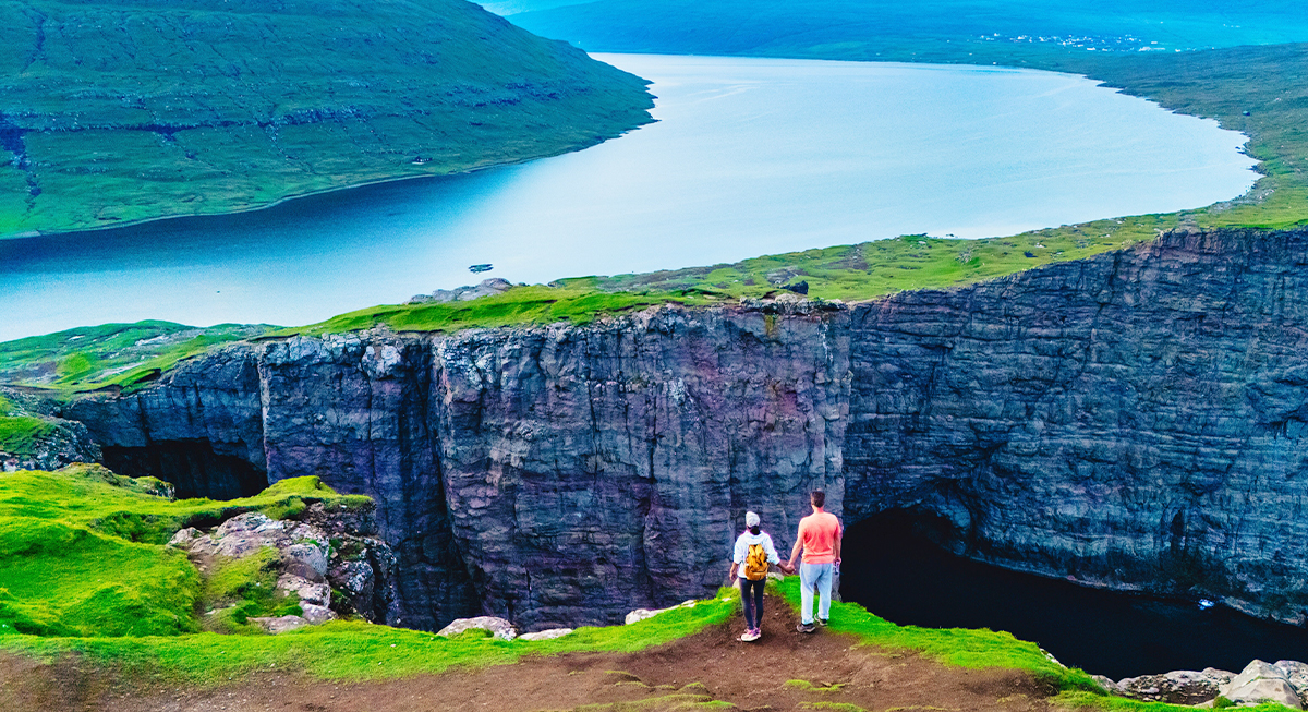
Image via iStockphoto/fokkebok
The best-known view of Lake Sørvágsvatn comes after a hike along the lake toward Trælanípa and Bøsdalafossur. The walk is generally considered manageable and usually takes about 45 minutes to an hour one way, with most round-trip trips lasting two to three hours, including stops. Along the trail, the lake stretches beside the path before the cliffs and coastline come into view near the southern end.
From certain angles, the lake and Atlantic Ocean appear unusually close together, creating the famous optical illusion. At Bøsdalafossur, water from the lake flows into the Atlantic, while the nearby sea stack Geituskoradrangur stands offshore beside the cliffs.
A Famous Spot With Local Rules
The trail has grown popular, so visitors should treat it as more than a casual photo stop. Local landowners manage access, and hikers usually pay a fee at the entrance area near the village of Miðvágur. Conditions can change quickly in the Faroe Islands, so sturdy shoes, layers, and a check of current trail guidance make the trip smoother.
The lake also carries a bit of local identity in its name. People in Sørvágur often call it Sørvágsvatn, while those closer to Miðvágur and Sandavágur often call it Leitisvatn. Some locals simply call it Vatnið, which means “the lake.”