10 U.S. Cities With the Most Confusing Street Layouts
Street maps aren’t always as logical as they look on paper. In several American cities, drivers face odd angles, sudden dead ends, or street names that change for no clear reason. Some of this comes from history; some from local geography; some from a lack of overall planning. Here are ten places where navigation challenges even people who know the area well.
Boston, Massachusetts
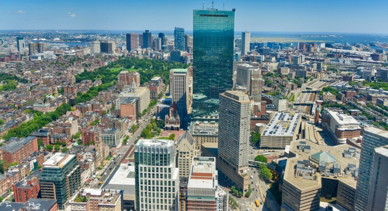
Credit: pixabay
No city causes GPS recalculations like Boston. Streets crisscross with no consistent pattern, curve without reason, and dead-end without warning. Many were built centuries ago before anyone considered traffic flow. Modern fixes like the Big Dig helped above and below ground, but didn’t make the roads any more logical.
Missoula, Montana
Credit: Getty Images
Downtown Missoula has grids that run into each other at odd angles, so intersections don’t always match up. In the Slant Streets area, roads cut diagonally through the rest of the pattern and seem to ignore nearby blocks. Steep hills complicate routes, and some areas have few street signs. It’s not unusual for even longtime residents to miss a turn or take the wrong exit.
Washington, D.C.
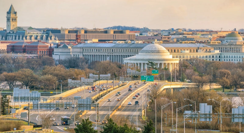
Credit: Getty Images
At first glance, D.C. looks organized. Then the diagonals hit. Pierre L’Enfant’s plan included grand radial avenues slicing through traditional blocks. Four quadrants overlap at the Capitol, and streets change names or directions depending on which quadrant you’re in.
Oakland, California
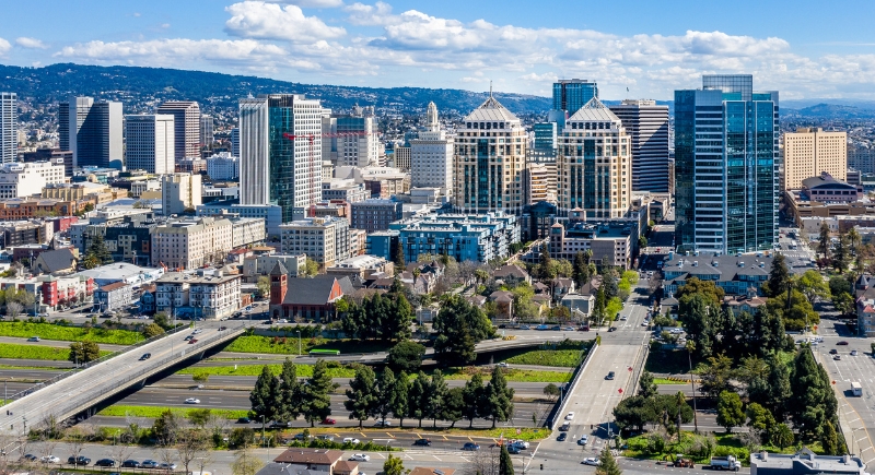
Credit: Getty Images
In Oakland’s hillside neighborhoods, roads take their shape from the land itself. Streets curve, split, and double back, sometimes ending at private gates or forming circles that don’t lead anywhere obvious. Montclair is one of several areas where navigation can get tricky, and GPS doesn’t always help. Locals often use landmarks or memory to get around.
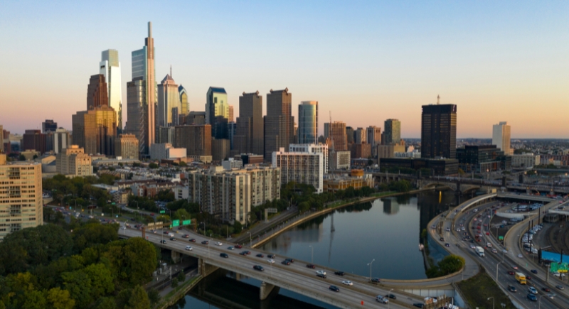
Philadelphia, Pennsylvania
Credit: Canva
Philly’s original grid is nearly 350 years old and works great in Center City. But as you step outside that core, things get strange. Numbered streets run into diagonals or vanish, while old colonial routes interrupt modern roads. Neighborhoods like Manayunk completely break the grid, using steep, narrow, and sometimes one-lane streets.
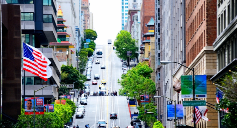
San Francisco, California
Credit: Getty Images
Street patterns in San Francisco rarely line up from one neighborhood to the next. Some grids were laid out before hills were taken into account, so intersections meet at strange angles and roads sometimes stop partway up a slope. Certain districts run on their own grid, unrelated to the rest of the city. Similar street names, like 10th Avenue and 10th Street, appear in totally different areas, making directions less straightforward than they seem.
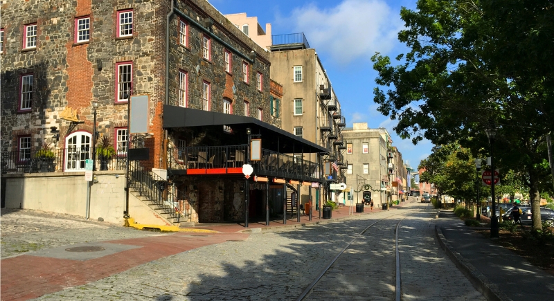
Savannah, Georgia
Credit: Getty Images
Squares define Savannah’s layout, but they don’t make things easier behind the wheel. The historic plan includes 24 public squares that interrupt nearly every straight route. Streets often circle or zigzag around the squares, and unfamiliar drivers may find themselves looping the same few blocks. It’s a layout made for strolling, not speeding.
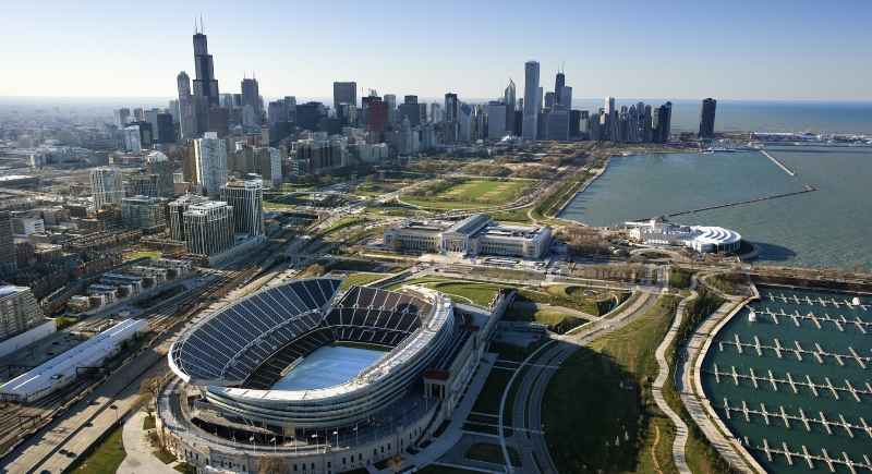
Chicago, Illinois
Credit: Canva
Chicago’s grid is deceptively logical until it collides with diagonals like Milwaukee or Ogden Avenue. These diagonal routes cut across the grid and intersect with multiple roads, creating chaotic five- and six-way intersections. Combine that with unpredictable one-ways and winter weather that hides lane markings, and it’s a recipe for confusion. The system helps locals navigate easily, but it leaves visitors second-guessing their turns at every major crossing.
New Orleans, Louisiana
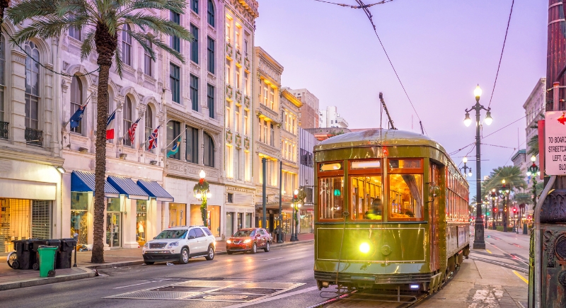
Credit: f11photo
In New Orleans, street names and directions often don’t match up with the map. Roads curve with the river and sometimes switch names from one block to the next. The layout in older areas like the French Quarter reflects old trade routes more than any city plan, and narrow streets can leave drivers feeling boxed in. Even today, signs aren’t always consistent, which only adds to the confusion.
Atlanta, Georgia
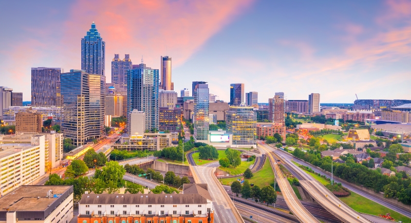
Credit: Getty Images
Street names repeat throughout Atlanta, especially anything called Peachtree. The road network grew from old railroad stops and crossroads, so many streets twist or end without warning, and very few run straight for long. Major interchanges like Spaghetti Junction add another layer of difficulty. It’s common for even locals to second-guess their directions in some neighborhoods.
Portland, Oregon
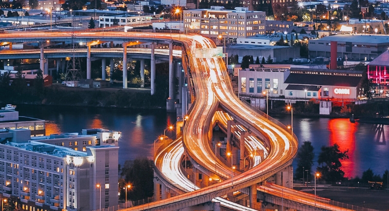
Credit: Getty Images
Tiny blocks make Portland walkable, but they also mean more stops and turns for drivers. The downtown core features 200-foot blocks that force quick decision-making. Outside downtown, neighborhoods like Ladd’s Addition abandon the grid entirely in favor of diagonal avenues and circular intersections. The city’s alphabetized and numbered street system is efficient in theory, until it throws you into a rotary or wraps you around a hidden garden cul-de-sac.
Clarksburg, West Virginia
Credit: Getty Images
Clarksburg’s streets follow the shape of the hills, so routes can disappear behind buildings or stop abruptly on steep grades. In winter, drivers often avoid the higher slopes altogether and leave their cars parked at the bottom. Several street names repeat in different parts of town, which can leave newcomers circling the same blocks or winding up miles from their intended stop.
Bellevue, Washington
Credit: pexels
In Bellevue’s Somerset neighborhood, roads seem more influenced by elevation than planning. Streets loop up hills and connect in unintuitive ways. It’s a prime example of topography trumping logic. House numbers feel random, and it’s common to pass the same intersection twice from two different angles.
Pittsburgh, Pennsylvania

Credit: Canva
Bridges and rivers slice Pittsburgh into dozens of oddly shaped sections. Streets often end abruptly at hillsides or tunnels, and two addresses that sound close may be separated by a valley or a river. Many roads are relics of trolley lines or coal routes, not modern transportation needs.
Los Angeles, California
Credit: Getty Images
In a city the size of a small country, street names stretch for miles with changing speed limits, lane counts, and directions. Some roads, like Venice Boulevard, shift character every few neighborhoods. Hillside areas, like Mount Washington and Laurel Canyon, feature narrow roads barely wide enough for one car, often without signage.