The Most Dangerous Hiking Trails in America
Not every hike leads to a picnic-worthy overlook or a mellow trail through the woods. Some paths test your nerves, your legs, and your grip on reality. These hikes have built a reputation for pushing people past their comfort zone—and sometimes, into full-on survival mode. Here are ten that really don’t mess around.
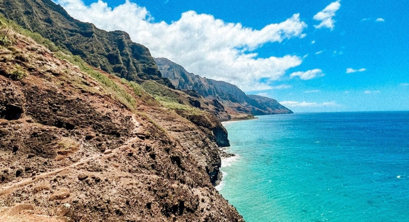
Kalalau Trail, Hawaii
Credit: Instagram
This cliffside route along Kauai’s Nā Pali Coast is as stunning as it is unforgiving. It features 11 miles through muddy slopes and sheer drop-offs, and flash floods have stranded hikers mid-trail more than once. Crawler’s Ledge, a narrow section with no guardrails, regularly sparks vertigo.
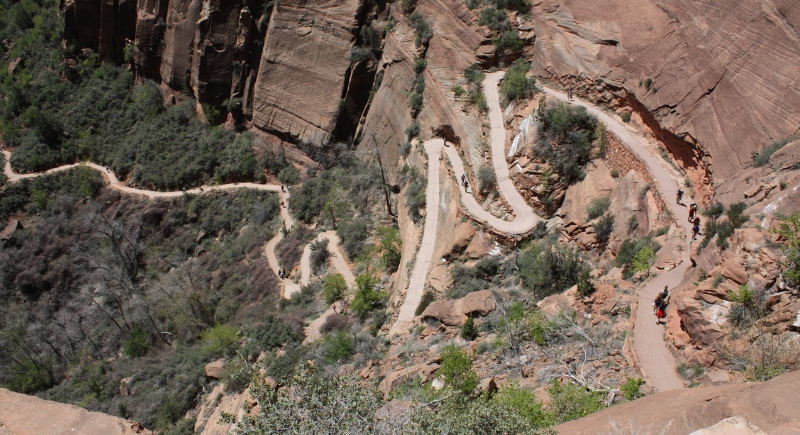
Angel’s Landing, Utah
Credit: Getty Images
A narrow ridge lined with chains and 1,000-foot drops on both sides is all that stands between hikers and the summit. Since 2004, over a dozen people have lost their lives attempting it. Permits are now required, mostly to manage crowds and reduce the risk of trail-side traffic jams.
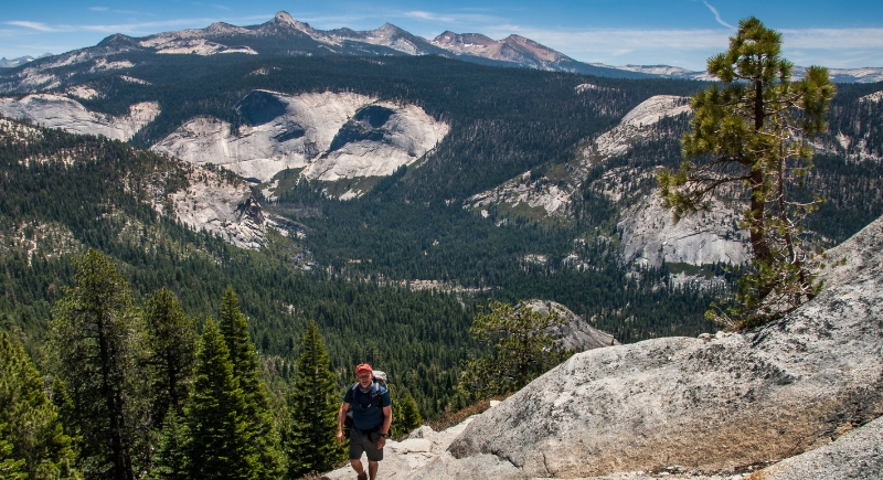
Mist Trail to Half Dome, California
Credit: Getty Images
The granite staircase up Vernal and Nevada Falls lives up to its name; it’s wet, slick, and risky. Half Dome’s infamous cables test both upper body strength and mental grit. Once you’re on that 400-foot vertical pull, there’s nothing but a cable and your shoes between you and a very long drop.
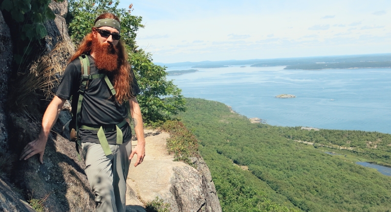
Precipice Trail, Maine
Credit: Getty Images
Acadia National Park doesn’t sound like a place for exposed cliffs and iron rungs, but this short trail goes vertical fast. Hikers scale steep granite using metal ladders without much room to pass others. The trail shuts down during falcon nesting season, anyway.
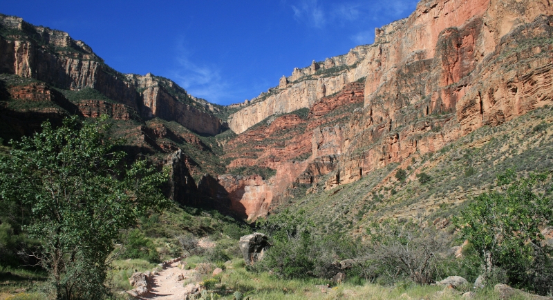
Bright Angel Trail, Arizona
Credit: Canva
It starts at a visitor center, is well-maintained, and you’ll pass mule trains. However, the danger lies in heat and overconfidence. Temperatures can reach 120°F in the summer, and most Grand Canyon rescues occur during this time, often due to heatstroke or exhaustion.
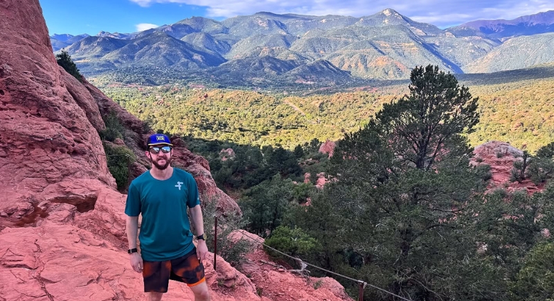
Barr Trail, Colorado
Credit: Instagram
Barr Trail to Pikes Peak isn’t a casual walk with lightning, altitude, and 13 miles of constant uphill hiking. Hikers gain over 7,000 feet in elevation, often hitting alpine terrain that’s storm-prone and oxygen-light. Afternoon thunderstorms roll in fast, and with little shelter above the treeline, the risk of lightning strikes is serious.
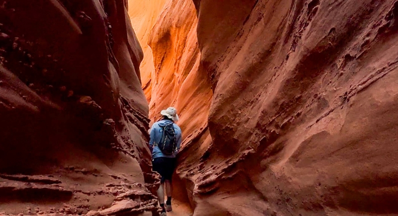
Spooky Gulch, Utah
Credit: Instagram
The trail narrows until backpacks need to come off just to squeeze through. Sudden storms from even miles away can cause flash floods that rush through the narrow canyon with no warning. With limited cell service and long distances to emergency help, it’s not a place to get careless with weather forecasts.
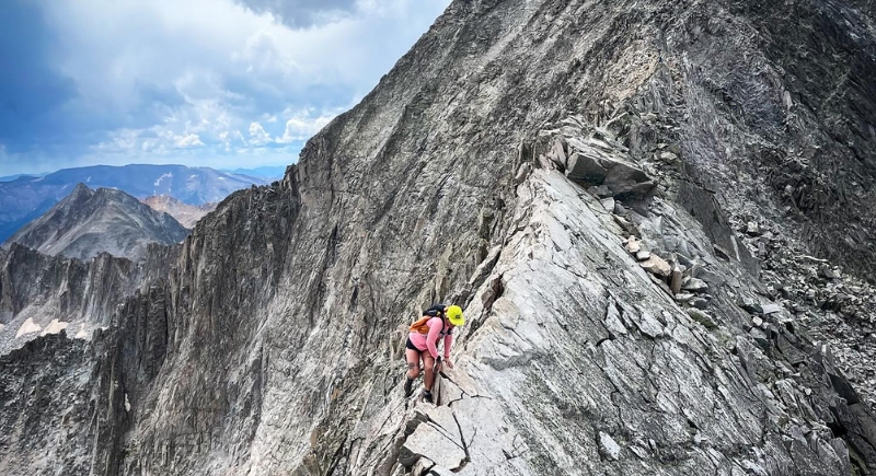
Knife Edge, Capitol Peak, Colorado
Credit: Instagram
Capitol Peak’s famous Knife Edge isn’t much wider than a balance beam, with 1,000-foot drop-offs on either side. This exposed rock spine has claimed lives, especially when loose rocks give way underfoot.
Tenaya Canyon, California
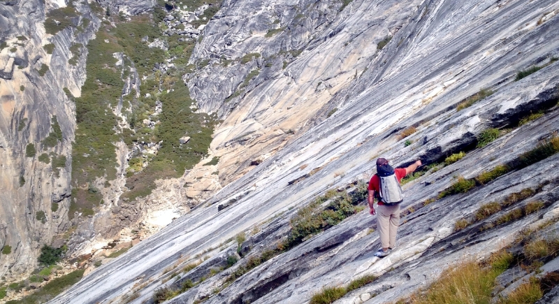
Credit: Wikimedia Commons
Yosemite’s Tenaya Canyon doesn’t have a marked trail, and that’s part of the problem. Slick granite and unmarked routes turn this canyon into a maze. Park officials have nicknamed it the park’s Bermuda Triangle. Over the years, several hikers have lost their lives or gone missing here.
Mount Washington, New Hampshire
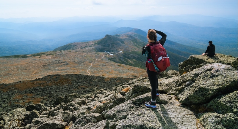
Credit: Instagram
Don’t let the modest height fool you. Mount Washington has recorded some of the highest wind speeds on Earth–231 mph at one point, and the weather changes by the minute. The Huntington Ravine Trail faces snow year-round, and in warm months, visibility drops fast in fog or storms.