15 American Highways That Are Absolute Death Traps
Highways are built to move us forward, but some stretches of pavement have a history of taking more than they give. Across the U.S., certain roads are known for tragedy, where crash rates soar, weather turns treacherous, or the terrain leaves no room for error. Whether you’re planning a road trip or your daily commute crosses one, these are the highways where caution isn’t optional.
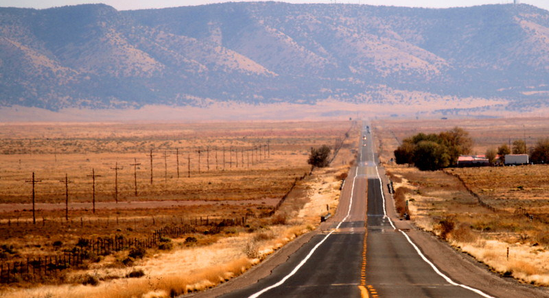
I-95
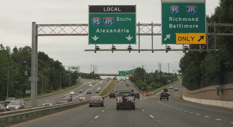
Credit: Wikimedia Commons
It doesn’t matter if you’re rolling through Miami or stuck in Northeast traffic; I-95 is chaos on pavement. Speeding, lane-weaving, and sudden weather shifts turn this coast-hugging freeway into a death trap. Federal data ranks it the most fatal highway in the U.S., with more than 280 deaths in a single year. For a road meant to connect, it sure knows how to divide.
I-4
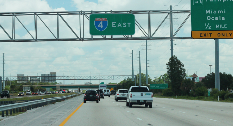
Credit: Wikimedia Commons
You wouldn’t think math could get dark until you start calculating more than one death for every mile between Tampa and Daytona Beach. Some say it’s because of distracted tourists, others say it’s the highway’s heavy merges plus unpredictable weather. Despite its short length, I-4 manages to claim the top spot for fatalities per mile in the country.
US-1 Florida Keys
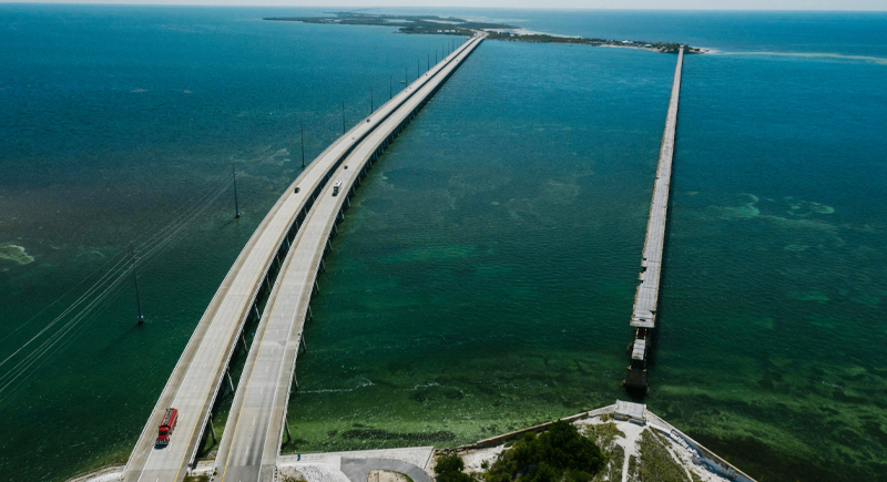
Credit: pexels
A dream road trip for some, a nightmare for emergency responders. US-1 slices across the Florida Keys with nothing but a guardrail between you and the ocean. One wrong move on this narrow two-laner can lead to tragedy. With poor lighting, unpredictable drivers, and limited space to recover, this stretch keeps rescue crews on edge year-round.
I-45
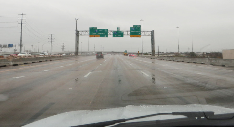
Credit: flickr
Drivers between Dallas and Houston know I-45 isn’t a place to relax. The volume of traffic and aggression all add up. Crash data shows this corridor has one of the highest death rates per mile nationwide. Every on-ramp feels like a warning, and every rush hour like a risk you’re forced to take.
Million Dollar Highway
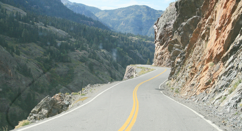
Credit: Wikimedia Commons
It’s not the name that’s chilling—it’s the lack of guardrails, hairpin turns, and zero forgiveness for driver error. US-550 in Colorado might offer priceless views, but one glance too long and you’ll miss your line. Locals know when to go slow, but tourists? Not always. This road’s margin of error is about the width of a tire.
CA-99
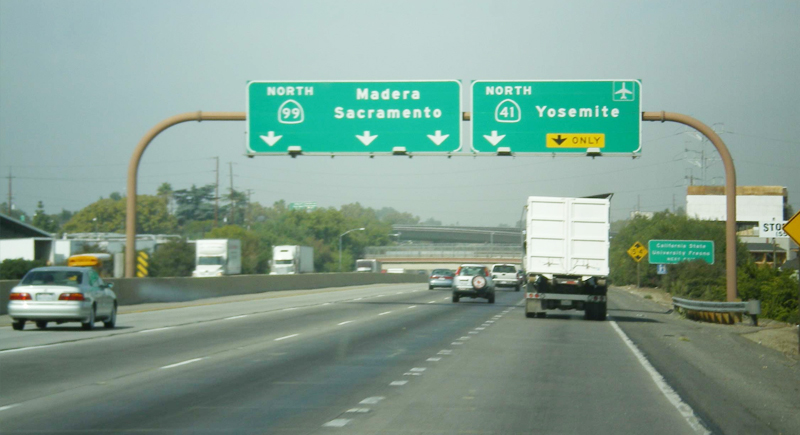
Credit: Wikimedia Commons
The Central Valley’s lifeline runs on California State Route 99, but it’s a lifeline with frayed ends. It recorded more than 445 deaths between 2018 and 2022, making it California’s most fatal highway. Because it runs through Fresno, Modesto, and Bakersfield, commercial or agricultural tractor-trailers dominate the road, and sudden slowdowns easily become chain-reaction pileups. Many segments have been flagged for urgent safety upgrades.
I-15 CA–NV
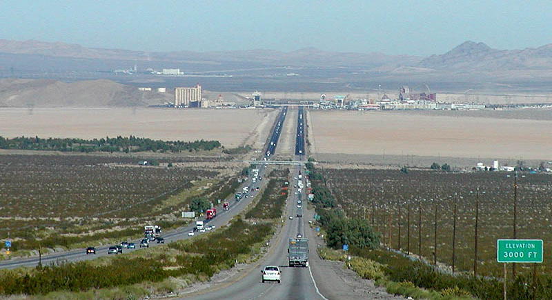
Credit: Wikimedia Commons
Drivers heading from Los Angeles to Las Vegas treat I-15 like a warm-up for the Strip. The straight, open desert encourages speeding, while drowsy or impaired drivers returning from Vegas make wrong moves. Between Barstow and Las Vegas, I-15 sees over 80 fatal crashes per year, with peak spikes on Fridays and Sundays. Nevada’s Department of Transportation’s “Zero Fatalities” campaign spans this zone.
Dalton Highway, AK
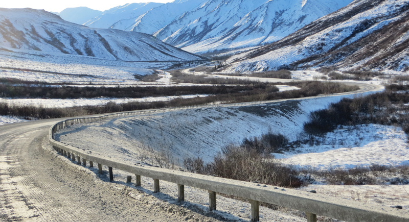
Credit: Wikimedia Commons
The Dalton Highway cuts through Arctic wilderness where cell signals vanish and the fastest help is to be expected in hours. It has no hospitals, only three small fueling stations. Drivers face blizzards, black ice, and wildlife collisions. In 2022, Alaska State Troopers reported 31 serious crashes along this highway, many caused by slide-offs into ditches during sub-zero whiteouts.
I-12 Louisiana
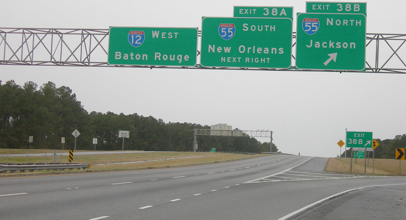
Credit: flickr
You wouldn’t expect an 86-mile bypass to rack up fatality stats, but I-12 punches above its weight with over 120 fatalities recorded between 2017 and 2022. This places it among the most dangerous interstates in the Southern region for fatal crashes. Traffic merges from older highways causes sudden slowdowns, and the interstate frequently floods during heavy Gulf storms.
MT-2
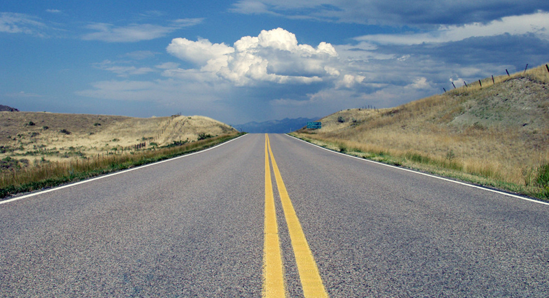
Credit: flickr
U.S. Route 2 in northern Montana may not be crowded, but it’s deadly. NHTSA frequently reports areas like this as having some of the slowest emergency response times in the country. Long straightaways dare commuters to excessive speeds despite a significant likelihood of wildlife crossings and black ice.
I-285 Atlanta
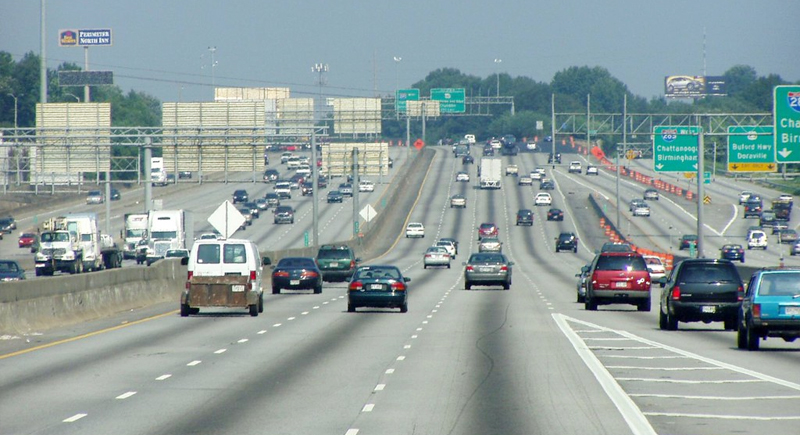
Credit: flickr
This 64‑mile loop sees over 2 million vehicles daily, including 13,000+ semi‑trucks reported in 2008 alone. The problem is that everyone’s in a hurry. Lane changes come fast and often, and the perimeter’s design forces constant decision-making at high speed. That’s a formula drivers rarely get right. In 2013, it recorded one of the highest fatal accident rates per mile nationally.
PCH Big Sur
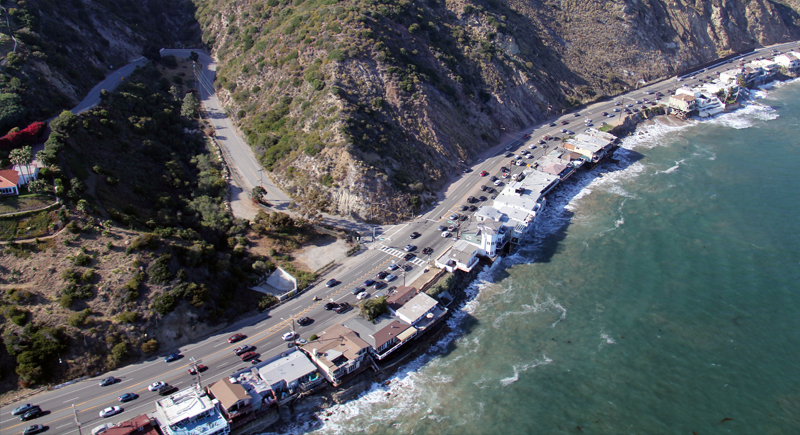
Credit: Wikimedia Commons
California’s coastal gem often hides its worst in plain sight. It has closed over 55 times due to landslides, mudflows, and erosion. A 2017 slide dumped 1.5 million tons of rock, burying a quarter‑mile stretch; another in 2024 dropped a lane into the ocean. The picturesque drive becomes a test of nerve and reflexes. It’s gorgeous until it isn’t.
Route 66 AZ
Credit: flickr
The Arizona stretch of historic Route 66 still pulls travelers off the interstates. Between Glenrio and Tucumcari, the old route earned the nickname “Slaughter Lane” in the late 1960s, with high crash rates on narrow two-lane stretches. Though decommissioned, this 40-mile strip still carries modern vehicles. Historic alignment wasn’t built for today’s speeds, contributing to persistent safety risks.
Pikes Peak Highway
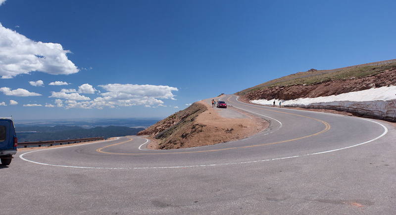
Credit: flickr
Climbing more than 14,000 feet, this Colorado mountain road invites casual tourists into serious terrain. No guardrails on steep descents, unpredictable weather, and thinner air that affects braking combine into hazardous conditions. One wrong turn, and it’s a vertical drop. There have been several fatalities during tourist drives and races.
I‑70: Rocky Mountains to Appalachians Kill Zone
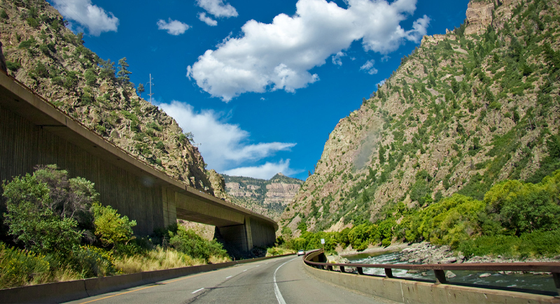
Credit: Wikimedia Commons
In 2019, I‑70 saw 158 fatalities, averaging 7.35 deaths per 100 miles. The highway snakes through both the Rocky and Appalachian Mountains, featuring tight mountain passes, steep descents, and sharp curves that challenge truckers and passenger vehicles alike. Heavy freight traffic combined with unpredictable weather makes brake failures, jackknifes, and rockslides common on this transcontinental route.