They Said It Was a Myth, But Archaeologists May Have Just Found the Lost City
For more than a thousand years, one of medieval Spain’s most debated cities survived mostly in written accounts. Chroniclers described it as dazzling and politically dominant. Scholars argued over its location without reaching any agreement, and excavations never produced decisive proof. Now, new archaeological research suggests the lost palace-city of Madinat al-Zāhira may have been sitting beneath farmland east of Córdoba the entire time.
This new theory began with landscape analysis. High-resolution LiDAR mapping has revealed terrain patterns that resemble buried architecture. Those findings have reopened one of the longest-running location debates in Islamic archaeology.
A Capital Built To Project Authority
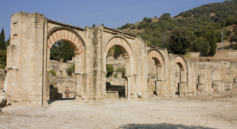
Image via Wikimedia Commons/archaeologist
Madinat al-Zāhira was constructed in the late 10th century under Almanzor, the dominant political and military force of late Umayyad al-Andalus.
Historical sources describe a monumental administrative capital designed to rival Madinat al-Zahra, the well-preserved palace-city west of Córdoba. At the time, major construction projects served political messaging as much as practical function. Urban design reflected stability, control, and legitimacy.
Unlike Madinat al-Zahra, which still survives as visible ruins, Madinat al-Zāhira almost completely disappeared after the civil war in the early 11th century. Buildings were likely stripped for reusable materials.
Over generations, the city faded from the physical landscape and survived mainly through historical texts. More than 20 location theories emerged over time, but none produced measurable archaeological confirmation.
When The Terrain Started Revealing Patterns

Image via Getty Images/Евгений Харитонов
Recent research led by University of Córdoba archaeologist Antonio Monterroso Checa focused on land near the Pendolillas Hills, roughly 12 kilometers east of Córdoba. Researchers analyzed LiDAR data from Spain’s National Geographic Institute, allowing detailed digital elevation mapping of the terrain.
The analysis revealed long, linear anomalies stretching across more than 1,200 meters. The shapes do not match natural erosion or geological layering. Instead, they resemble buried structural remains. The patterns indicate organized construction, including rectangular and square building foundations, terraced structural zones adapted to hillside terrain, and sections of planned street alignment.
The mapped footprint covers roughly 120 hectares. The measurement closely matches the scale of Madinat al-Zahra.
A Landscape That Stayed Under Elite Control
Historical documentation adds context to the terrain evidence by showing that the same land later served as royal pastureland. By the 15th century, it was tied to the management of royal domains. During the reign of Philip II, the area became part of Spain’s Royal Stud Farms.
Long-term royal or state control often limits large-scale construction or agricultural restructuring. Such restricted use increases the likelihood that older archaeological layers remain intact beneath the surface.
Across multiple historical periods, the land remained repeatedly linked to centralized authority, which aligns with historical descriptions of Madinat al-Zāhira as a seat of ruling power.
Evidence That Moves Beyond Text-Based Theories

Image via Wikimedia Commons/Superchilum
Earlier location theories depended mainly on medieval chronicles or geographic interpretation. The current research combines terrain mapping, historical documentation, and urban pattern analysis. LiDAR provides measurable topographical anomalies. Historical accounts describe a monumental planned city. The geographic scale and location now align with both lines of evidence.
Similar LiDAR methods have already helped identify hundreds of previously unknown archaeological sites across southern Spain, so there is confidence in the reliability of the technology.
A City That May Reappear Through Excavation
If excavation confirms the findings, the discovery would significantly reshape understanding of late Umayyad Córdoba. It would refine maps of political geography in medieval Iberia and provide new evidence about how cities were built, abandoned, dismantled, and erased during periods of conflict.
Researchers are still cautious. The current data strongly suggest a large buried urban complex consistent with historical descriptions, but physical excavation remains necessary for confirmation. The process can take years depending on funding, conservation planning, and site protection measures.
Even so, for the first time in over a thousand years, researchers are focusing on a specific landscape. If future excavation supports the LiDAR evidence, Madinat al-Zāhira will shift from historical speculation into documented archaeological reality.